Protecting Lives. Protecting Property. Protecting the Future. This mission drives the work of the Lower Platte North Natural Resource District (LPNNRD), which serves 28 communities and manages more than one million acres of land in east-central Nebraska.
The LPNNRD plays a critical role in safeguarding the region’s natural resources, from flood control and groundwater management to erosion prevention and habitat conservation. Federal funding is essential to advancing this mission, enabling the district to implement large-scale projects and invest in long-term sustainability for the region.
One of the most crucial responsibilities of Nebraska’s Natural Resources Districts (NRDs) is flood control, which provides immense value to both farmers and residents. By managing floodwaters and constructing flood control structures, the LPNNRD helps mitigate damage from extreme rain events that devastate crops, homes, and infrastructure.
Another key focus is improving groundwater quality, particularly addressing nitrate contamination. By working directly with agricultural producers, the NRDs promote best management practices that enhance soil health while reducing pollutants in Nebraska’s water supply.
Much of an NRD’s funding comes from local property taxes, but federal assistance plays a crucial role in tackling large-scale projects. Brandon Beethe, GIS/Grants Coordinator for LPNNRD, emphasized the importance of federal grants in expanding the district’s impact.
“Funding from the Federal Emergency Management Agency (FEMA) and the Natural Resources Conservation Services (NRCS) allows us to take on major projects that otherwise wouldn’t be possible,” Beethe said.
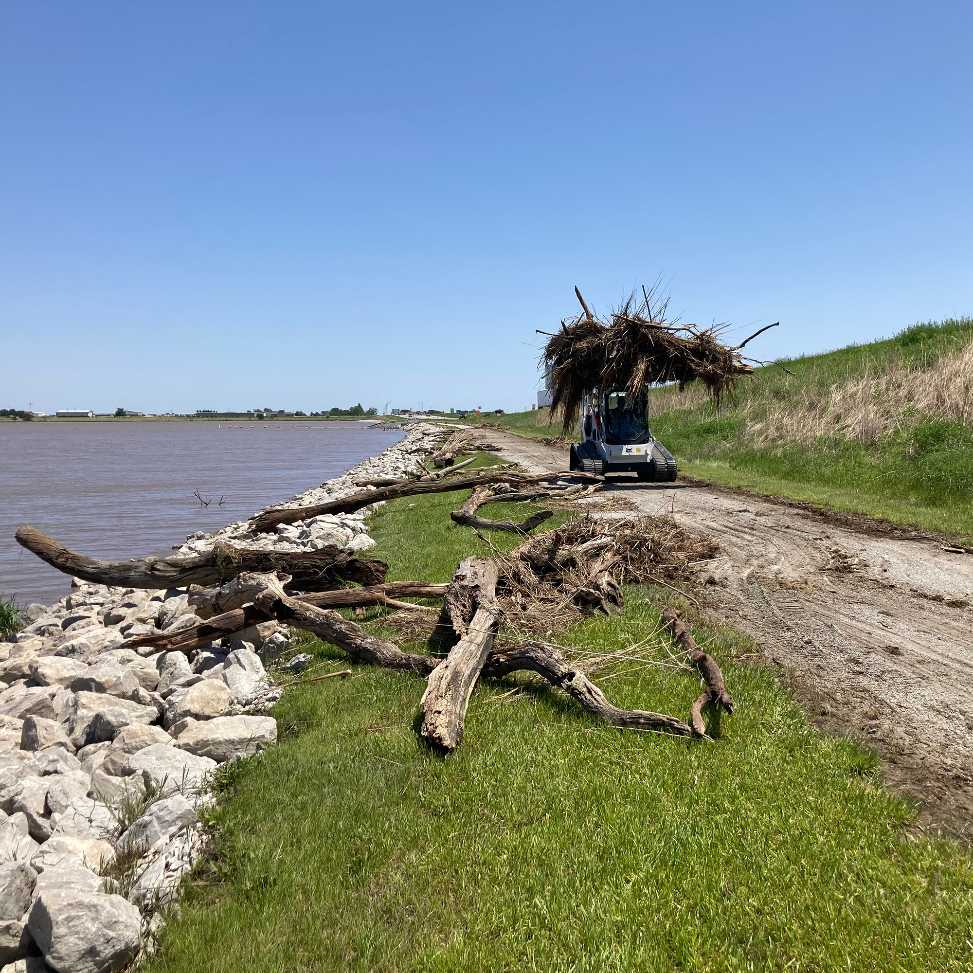
For example, consider the May 2024 storm that battered the Wahoo Creek Basin. The storm caused more than $1 million in damages to local flood control structures, including portions of the Wanahoo Recreation Area and Wanahoo Dam outlet. Fortunately, FEMA has committed to covering 75% of the restoration costs, ensuring these essential flood control and recreational areas can be fully repaired.
In addition to disaster recovery, LPNNRD is focused on long-term watershed planning. A recent grant from the NRCS is funding a supplemental watershed plan for the Cottonwood Creek 21A dam structure, a critical flood control system that also serves as a roadway. Years of road maintenance has altered the spillway’s shape, impacting its ability to function during flood events. Thanks to federal funding, preliminary engineering work will explore alternative designs to restore the dam’s full flood control capacity without requiring any financial contribution from the LPNNRD.
For many years, the Shell Creek Watershed has benefited from Environmental Protection Agency (EPA) Section 319 funds through the Nebraska Department of Environment and Energy. The LPNNRD has focused on employing best management practices to address nonpoint source pollution. These practices help producers construct terraces, establish grassed waterways, and plant buffer strips along field edges. Such measures are designed to capture pollutants before they reach the waterways, thereby improving water quality. To encourage adoption, the LPNNRD offers cost-sharing incentives to mitigate the financial impact on producers who may need to remove portions of their land from production.
Federal grants from agencies like FEMA, NRCS, and the EPA play a vital role in supporting the LPNNRD’s efforts, ensuring they have the funding needed to protect Nebraska’s communities and natural resources.
Continued federal investment allows the LPNNRD and NRDs across the state to maintain flood control structures, support sustainable agriculture, improve water quality, and enhance outdoor recreation. Community members can help protect these resources by advocating for federal funding and ensuring that Nebraska’s conservation programs remain a priority at the national level.
“Without federal support, the NRDs would be severely limited in what they can do,” Beethe said.
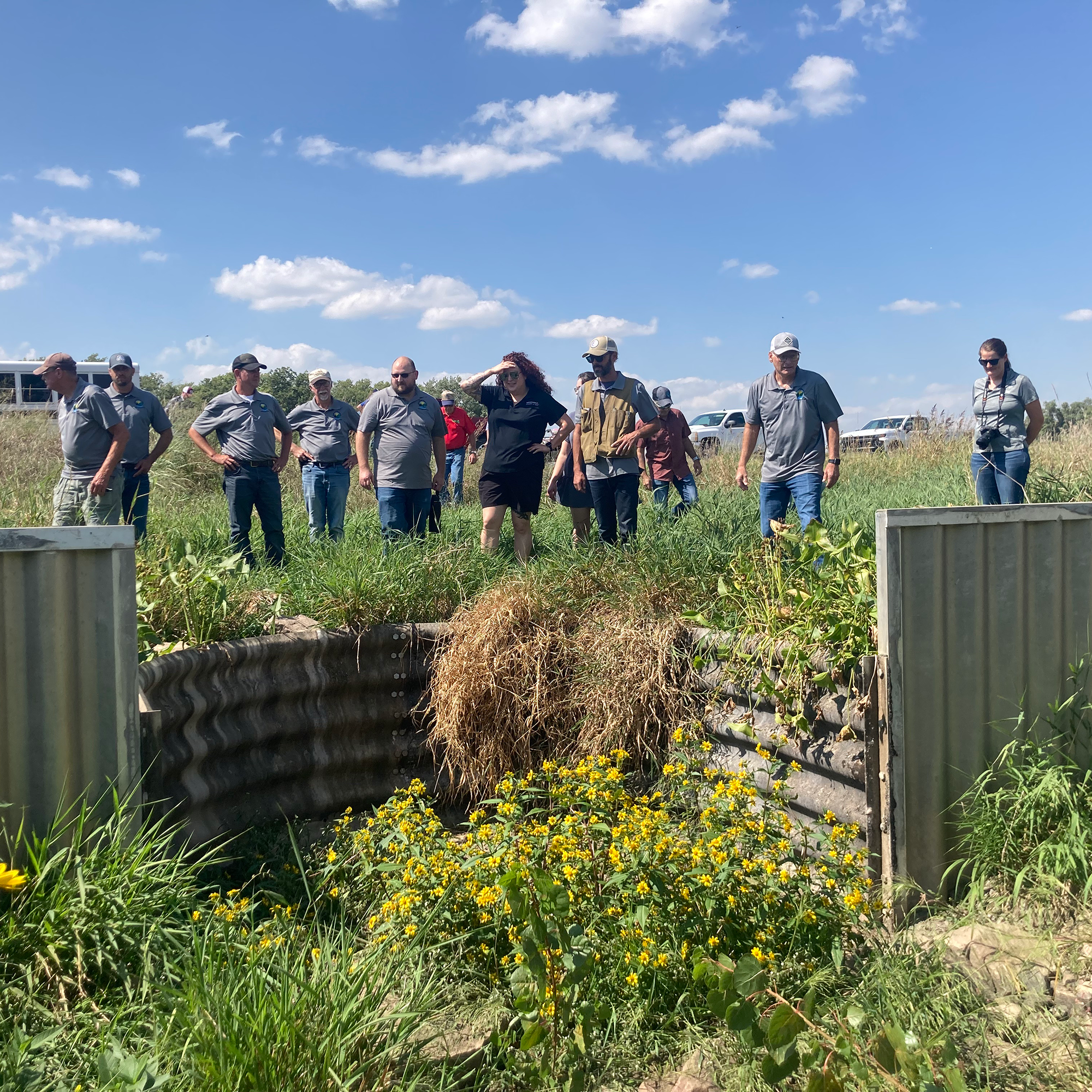
Feature photos—Top: A group surveys a grade stabilization drop structure near Shell Creek. Second photo: Debris cleanup at Wanahoo.